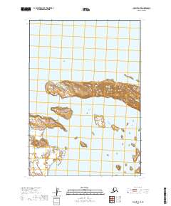
2019 Map of Ugashik D-1 SE
USGS Topo · Published 2019About this map
Becharof Lake dominates this Alaskan landscape within the Lake and Peninsula Borough. The map centers on the distinctive landform of Severson Peninsula, which extends into the vast freshwater basin. The shoreline topography is documented in detail, showing the small islands and peninsulas that characterize this remote subarctic environment. To the southwest, Featherly Creek flows toward the lake, cutting through the low-lying coastal terrain. This 2019 survey provides a precise look at the hydrography and elevation of this wilderness area, where the intersection of water and land is the primary feature. The lack of roads or settlements underscores the untouched nature of the Alaskan Peninsula during the early twenty-first century.
Find a feature on this map
7 named features on this map. Tap any name to fly to it.
Don’t see what you’re looking for? This feature index may not catch every label — zoom into the map to look around manually.
Map Details
Editions of this 2019 Ugashik D-1 SE Map
This is the sole edition of this map. No revisions or reprints were ever made.
Other maps of this area

1943 · Ugashik
USGS Topo · 1:250,000

1948 · Ugashik
USGS Topo · 1:250,000

1949 · Ugashik
USGS Topo · 1:250,000

1951 · Karluk
USGS Topo · 1:250,000

1951 · Ugashik D-1
USGS Topo · 1:63,360

1951 · Ugashik C-1
USGS Topo · 1:63,360

1951 · Karluk D-6
USGS Topo · 1:63,360
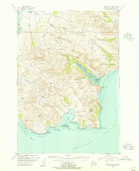
1951 · Karluk C-6
USGS Topo · 1:63,360

1952 · Karluk
USGS Topo · 1:250,000

1963 · Ugashik
USGS Topo · 1:250,000