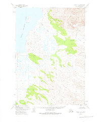
1951 Map of Ugashik C-2
USGS Topo · Published 1975About this map
Mt Peulik dominates the northeastern landscape of this quadrangle, its volcanic slopes giving way to extensive lava flows that reach toward the lowlands. The western edge is defined by the shoreline of Upper Ugashik Lake, where a network of tundra streams and marshy terrain begins. This 1951 survey, based on aerial photography from the same year, illustrates a complex drainage system fed by the mountain's elevations. Waterways like Hot Springs Creek and Ugashik Creek flow through the northern reaches, while Crooked Creek and Moore Creek wind through the central valleys. To the south, Deer Creek and Des Moines Creek highlight the unpopulated and unroaded nature of the Alaska Peninsula during the mid-20th century, where land lines remained largely unsurveyed by the Bureau of Land Management.
Find a feature on this map
10 named features on this map. Tap any name to fly to it.
Don’t see what you’re looking for? This feature index may not catch every label — zoom into the map to look around manually.
Map Details
Editions of this 1951 Ugashik C-2 Map
2 editions found
Other maps of this area

1943 · Ugashik
USGS Topo · 1:250,000

1948 · Ugashik
USGS Topo · 1:250,000

1949 · Ugashik
USGS Topo · 1:250,000

1951 · Ugashik B-1
USGS Topo · 1:63,360

1951 · Ugashik B-3
USGS Topo · 1:63,360

1951 · Ugashik D-1
USGS Topo · 1:63,360

1951 · Ugashik C-1
USGS Topo · 1:63,360

1951 · Ugashik C-2
USGS Topo · 1:63,360

1951 · Ugashik D-3
USGS Topo · 1:63,360

1951 · Ugashik C-3
USGS Topo · 1:63,360