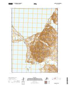
2019 Map of Ugashik C-3 SE
USGS Topo · Published 2019About this map
Upper Ugashik Lake and Lower Ugashik Lake dominate this landscape on the Alaska Peninsula, separated by a narrow passage of land. This coastal wilderness is defined by the high elevations of the Aleutian Range, which rises sharply between the lake systems. The map documents the vital infrastructure of the region, specifically the Ugashik Narrows Airport, providing essential aerial access to this part of Lake and Peninsula Borough. The terrain shows a complex network of wetlands and contour lines that illustrate the dramatic transition from the water's edge to the high peaks of the range, offering a precise look at the geography within T30S R46W and T31S R46W before further environmental shifts or development change these remote corridors.
Find a feature on this map
8 named features on this map. Tap any name to fly to it.
Don’t see what you’re looking for? This feature index may not catch every label — zoom into the map to look around manually.
Map Details
Editions of this 2019 Ugashik C-3 SE Map
This is the sole edition of this map. No revisions or reprints were ever made.
Other maps of this area

1943 · Ugashik
USGS Topo · 1:250,000

1948 · Ugashik
USGS Topo · 1:250,000

1949 · Ugashik
USGS Topo · 1:250,000

1951 · Ugashik B-3
USGS Topo · 1:63,360

1951 · Ugashik C-2
USGS Topo · 1:63,360

1951 · Ugashik C-3
USGS Topo · 1:63,360

1951 · Ugashik B-2
USGS Topo · 1:63,360

1963 · Ugashik
USGS Topo · 1:250,000
2019 · Ugashik C-3 NE
USGS Topo · 1:25,000
2019 · Ugashik B-3 NE
USGS Topo · 1:25,000