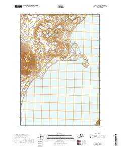
2019 Map of Ugashik C-3 NE
USGS Topo · Published 2019About this map
Upper Ugashik Lake dominates the eastern half of this terrain in the Lake and Peninsula Borough, where the freshwater expanse meets a complex shoreline of small bays and points. The landscape is defined by the Public Land Survey System grid, specifically within T28s R46w, T28s R45w, and T29s R46w. This survey, produced by the U.S. Geological Survey, illustrates a remote coastal environment devoid of named roads or established settlements. The western portion of the map shows significant elevation changes, with contours tracking the ascent away from the lake basin. The lack of infrastructure highlights the wild character of the Alaska Peninsula, where land use is dictated by natural hydrology rather than human development.
Find a feature on this map
6 named features on this map. Tap any name to fly to it.
Don’t see what you’re looking for? This feature index may not catch every label — zoom into the map to look around manually.
Map Details
Editions of this 2019 Ugashik C-3 NE Map
This is the sole edition of this map. No revisions or reprints were ever made.
Other maps of this area

1943 · Ugashik
USGS Topo · 1:250,000

1948 · Ugashik
USGS Topo · 1:250,000

1949 · Ugashik
USGS Topo · 1:250,000

1951 · Ugashik C-2
USGS Topo · 1:63,360

1951 · Ugashik D-3
USGS Topo · 1:63,360

1951 · Ugashik C-3
USGS Topo · 1:63,360

1951 · Ugashik D-2
USGS Topo · 1:63,360

1963 · Ugashik
USGS Topo · 1:250,000
2019 · Ugashik D-3 SE
USGS Topo · 1:25,000
2019 · Ugashik C-3 SE
USGS Topo · 1:25,000