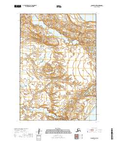
2019 Map of Ugashik D-3 SE
USGS Topo · Published 2019About this map
Becharof Lake defines the northern edge of this remote Alaskan terrain, where the vast drainage system of the Alaska Peninsula begins its descent toward the coast. The landscape is characterized by complex glacial topography and numerous unnamed kettle ponds, reflecting a late 20th-century wilderness state largely untouched by permanent infrastructure. In the southern reach of the sheet, the waters of Upper Ugashik Lake emerge, marking the boundary between significant watershed basins. This 2019 survey documents the intricate hydrologic patterns and elevation contours within the Lake and Peninsula Borough, providing a precise record of the land within the t27s r46w and t28s r46w townships. The absence of roads or named settlements emphasizes the character of the peninsula as a preserved natural corridor for regional wildlife and seasonal hydrologic flow.
Find a feature on this map
5 named features on this map. Tap any name to fly to it.
Don’t see what you’re looking for? This feature index may not catch every label — zoom into the map to look around manually.
Map Details
Editions of this 2019 Ugashik D-3 SE Map
This is the sole edition of this map. No revisions or reprints were ever made.
Other maps of this area

1943 · Ugashik
USGS Topo · 1:250,000

1948 · Ugashik
USGS Topo · 1:250,000

1949 · Ugashik
USGS Topo · 1:250,000

1951 · Ugashik C-2
USGS Topo · 1:63,360

1951 · Ugashik D-3
USGS Topo · 1:63,360

1951 · Ugashik C-3
USGS Topo · 1:63,360

1951 · Ugashik D-2
USGS Topo · 1:63,360

1963 · Ugashik
USGS Topo · 1:250,000
2019 · Ugashik D-3 NE
USGS Topo · 1:25,000
2019 · Ugashik D-2 NW
USGS Topo · 1:25,000