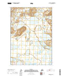
2019 Map of Ugashik C-4 NW
USGS Topo · Published 2019About this map
Wetlands and unnamed lakes dominate this section of the Alaska Peninsula within the Lake and Peninsula Borough. This map presents a landscape defined by its hydrography, showing a dense network of water bodies and marshlands that reflect the region's complex drainage patterns. The lack of named settlements or transportation infrastructure underscores the wilderness character of the area, which is organized primarily by the Public Land Survey System grid. Survey lines for T28s R49w, T28s R48w, and T29s R49w provide the only formal geographical markers across this terrain, where small hills and ridges rise amidst the broader saturation of the flats. For the researcher, this sheet offers a precise record of the natural topography and water distribution in the early twenty-first century.
Find a feature on this map
5 named features on this map. Tap any name to fly to it.
Don’t see what you’re looking for? This feature index may not catch every label — zoom into the map to look around manually.
Map Details
Editions of this 2019 Ugashik C-4 NW Map
This is the sole edition of this map. No revisions or reprints were ever made.
Other maps of this area

1943 · Ugashik
USGS Topo · 1:250,000

1948 · Ugashik
USGS Topo · 1:250,000

1949 · Ugashik
USGS Topo · 1:250,000

1951 · Ugashik C-5
USGS Topo · 1:63,360

1951 · Ugashik C-4
USGS Topo · 1:63,360

1951 · Ugashik D-5 and D-6
USGS Topo · 1:63,360

1951 · Ugashik D-4
USGS Topo · 1:63,360

1963 · Ugashik
USGS Topo · 1:250,000
2019 · Ugashik C-4 NE
USGS Topo · 1:25,000
2019 · Ugashik C-4 SW
USGS Topo · 1:25,000