
1951 Map of Ugashik C-5
USGS Topo · Published 1956About this map
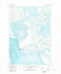
Pilot Point and the maritime infrastructure of the Alaska Peninsula are captured here during the early 1950s. The settlement at Pilot Point is shown with its commercial and navigational landmarks, including a Cannery and Water Towers, situated along the eastern shore of Ugashik Bay. The coastal landscape is defined by extensive Tidal Flats that transition into a complex network of wetlands and tundra ponds to the north and east.
Find a feature on this map
10 named features on this map. Tap any name to fly to it.
Don’t see what you’re looking for? This feature index may not catch every label — zoom into the map to look around manually.
Map Details
Editions of this 1951 Ugashik C-5 Map
2 editions found
Other maps of this area

1943 · Ugashik
USGS Topo · 1:250,000

1948 · Ugashik
USGS Topo · 1:250,000

1949 · Ugashik
USGS Topo · 1:250,000

1951 · Ugashik C-4
USGS Topo · 1:63,360

1951 · Ugashik D-5 and D-6
USGS Topo · 1:63,360

1951 · Ugashik D-4
USGS Topo · 1:63,360

1951 · Ugashik C-6
USGS Topo · 1:63,360

1954 · Ugashik B-4
USGS Topo · 1:63,360

1954 · Ugashik B-5
USGS Topo · 1:63,360

1963 · Ugashik B-6
USGS Topo · 1:63,360