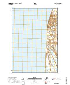
2019 Map of Ugashik C-6 NE
USGS Topo · Published 2019About this map
Bristol Bay dominates this coastal survey, where the waters of the Bay meet the shores of the Alaska Peninsula in Lake and Peninsula Borough. The terrain is defined by the prominent headland of Cape Greig, a landmark that anchors the coastline against the shifting winds and tides of the region. This 2019 survey documents a landscape of intricate coastal wetlands and ponds situated behind the shoreline, showing the natural drainage patterns and topographical boundaries like t28s r51w and t29s r52w that segment this part of the Alaskan wilderness. The map provides a clear record of the interface between the open sea and the low-lying, water-braided land typical of the northern peninsula.
Find a feature on this map
6 named features on this map. Tap any name to fly to it.
Don’t see what you’re looking for? This feature index may not catch every label — zoom into the map to look around manually.
Map Details
Editions of this 2019 Ugashik C-6 NE Map
This is the sole edition of this map. No revisions or reprints were ever made.
Other maps of this area

1943 · Ugashik
USGS Topo · 1:250,000

1948 · Ugashik
USGS Topo · 1:250,000

1949 · Ugashik
USGS Topo · 1:250,000

1951 · Ugashik C-5
USGS Topo · 1:63,360

1951 · Ugashik D-5 and D-6
USGS Topo · 1:63,360

1951 · Ugashik C-6
USGS Topo · 1:63,360

1963 · Ugashik
USGS Topo · 1:250,000
2019 · Ugashik C-5 NW
USGS Topo · 1:25,000
2019 · Ugashik C-5 SW
USGS Topo · 1:25,000
2019 · Ugashik C-6 SE
USGS Topo · 1:25,000