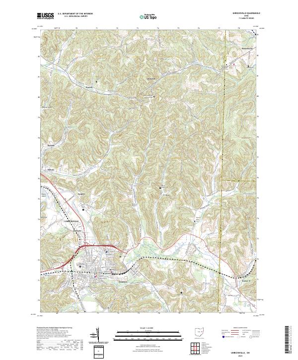
2023 Map of Uhrichsville
USGS Topo · Published 2023About this map
The Tuscarawas River and Stillwater Creek converge in this corner of eastern Ohio, defining the industrial and residential corridors of Uhrichsville and Dennison. This 2023 survey illustrates a landscape deeply shaped by its valley geography and transportation history, where towns like Midvale, Barnhill, and Eastport follow the contours of the waterways. The presence of the Tuscarawas County Courthouse Southern District in Dennison underscores the town's historical civic importance, while the scattered cemeteries—including Oxford Methodist Episcopal Cem and Saint Elizabeth Cem—point to the early pioneer and religious foundations of the surrounding rural townships.
Find a feature on this map
99 named features on this map. Tap any name to fly to it.
Don’t see what you’re looking for? This feature index may not catch every label — zoom into the map to look around manually.
Map Details
Editions of this 2023 Uhrichsville Map
This is the sole edition of this map. No revisions or reprints were ever made.
Other maps of this area

1902 · Scio
USGS Topo · 1:62,500

1904 · Scio
USGS Topo · 1:62,500

1909 · Uhrichsville
USGS Topo · 1:62,500

1910 · Carrollton
USGS Topo · 1:62,500

1911 · Uhrichsville
USGS Topo · 1:62,500

1912 · Dover
USGS Topo · 1:62,500

1912 · Carrollton
USGS Topo · 1:62,500

1944 · Dover
USGS Topo · 1:62,500

1951 · Canton
USGS Topo · 1:250,000

1953 · Canton
USGS Topo · 1:250,000