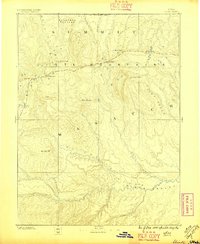
1885 Map of Uinta
USGS Topo · Published 1896About this map
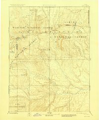
The Uinta Mountains dominate this late nineteenth-century survey, forming a massive east-west topographic spine across the northeastern Utah landscape. Originating from the work of the King and Powell surveys, the map illustrates a complex drainage network where high-altitude peaks like Gilbert Peak and Emmons Peak feed several major river systems. To the south, the Duchesne River and Uinta River descend through deep canyons toward the broad Uinta Valley. The survey records a transition from the high, plateau-like summits of Rhodes Plateau and Concrete Plateau in the west to the deeply dissected terrain of the east. These hydrological patterns, including the courses of Strawberry Creek and Lake Fork, delineate the early understanding of this territory long before the widespread development of modern infrastructure in the Summit and Wasatch regions.
Find a feature on this map
26 named features on this map. Tap any name to fly to it.
Don’t see what you’re looking for? This feature index may not catch every label — zoom into the map to look around manually.
Map Details
Editions of this 1885 Uinta Map
6 editions found
Other maps of this area

1885 · Salt Lake
USGS Topo · 1:250,000

1885 · Manti
USGS Topo · 1:250,000

1885 · East Tavaputs
USGS Topo · 1:250,000

1885 · Ashley
USGS Topo · 1:250,000

1885 · Uinta
USGS Topo · 1:250,000

1886 · Price River
USGS Topo · 1:250,000

1895 · Manti
USGS Topo · 1:250,000

1896 · Price River
USGS Topo · 1:250,000

1900 · Coalville
USGS Topo · 1:125,000

1901 · Hayden Peak
USGS Topo · 1:125,000