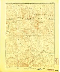
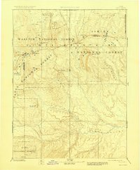
1885 Map of Uinta
USGS Topo · Published 1905About this map
The Uinta Mountains dominate this reconnaissance-scale survey, showing a landscape defined by high alpine peaks and the radiating drainage systems of the eastern Uinta Basin. This 1880s-era topography, based on the work of the King and Powell Surveys, highlights the source waters for several major river systems. To the north, the Bear River flows toward the Great Salt Lake, while the southern slopes feed the extensive Duchesne River network, including Lake Fork and Strawberry Creek.
Find a feature on this map
27 named features on this map. Tap any name to fly to it.
Don’t see what you’re looking for? This feature index may not catch every label — zoom into the map to look around manually.
Map Details
Editions of this 1885 Uinta Map
6 editions found
Other maps of this area

1885 · Salt Lake
USGS Topo · 1:250,000

1885 · Manti
USGS Topo · 1:250,000

1885 · East Tavaputs
USGS Topo · 1:250,000

1885 · Ashley
USGS Topo · 1:250,000

1885 · Uinta
USGS Topo · 1:250,000

1886 · Price River
USGS Topo · 1:250,000

1895 · Manti
USGS Topo · 1:250,000

1896 · Price River
USGS Topo · 1:250,000

1900 · Coalville
USGS Topo · 1:125,000

1901 · Hayden Peak
USGS Topo · 1:125,000