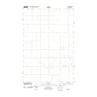
2010 Map of Ulen NW
USGS Topo · Published 2010About this map
South Branch Wild Rice River meanders across this rural section of Clay County, defining the drainage patterns of the agricultural landscape. The area is organized by a strict grid of gravel and paved roads, reflecting the systematic land division characteristic of the region. Near the intersection of County Hwy-102 and 400 St, the Jevnaker Cemetery provides a tangible link to the area's early settlers and genealogical history. Transportation and local access are facilitated by a network including County Hwy-33 and County Hwy-26, which connect the scattered farmsteads and agricultural properties that characterize this part of Minnesota just after the first decade of the new millennium.
Find a feature on this map
20 named features on this map. Tap any name to fly to it.
Don’t see what you’re looking for? This feature index may not catch every label — zoom into the map to look around manually.
Map Details
Editions of this 2010 Ulen NW Map
This is the sole edition of this map. No revisions or reprints were ever made.
Other maps of this area

1918 · Twin Valley
USGS Topo · 1:62,500

1918 · Ulen
USGS Topo · 1:62,500

1924 · Ada
USGS Topo · 1:62,500

1952 · Grand Forks
USGS Topo · 1:250,000

1956 · Grand Forks
USGS Topo · 1:250,000

1965 · Twin Valley SW
USGS Topo · 1:24,000

1965 · Twin Valley
USGS Topo · 1:24,000

1965 · Syre
USGS Topo · 1:24,000
1965 · Ada
USGS Topo · 1:24,000
1965 · Ulen NW
USGS Topo · 1:24,000