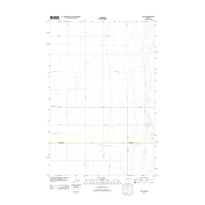
2013 Map of Ulen NW
USGS Topo · Published 2013About this map
The agricultural divide between Norman and Clay counties defines this western Minnesota landscape, where the S Br Wild Rice River meanders across a meticulously surveyed grid of township roads. This 2013 survey illustrates the enduring patterns of rural settlement, anchored by the Winchester Cem in the northwest and Jevnaker Cem further south. The flat terrain is crossed by a network of arterial routes including Co Hwy-26 and numerous section-line roads like 120th Ave and 400 St. This map is a valuable resource for those studying the precise boundaries of land ownership and the location of local landmarks in the Red River Valley region.
Find a feature on this map
19 named features on this map. Tap any name to fly to it.
Don’t see what you’re looking for? This feature index may not catch every label — zoom into the map to look around manually.
Map Details
Editions of this 2013 Ulen NW Map
This is the sole edition of this map. No revisions or reprints were ever made.
Other maps of this area

1918 · Twin Valley
USGS Topo · 1:62,500

1918 · Ulen
USGS Topo · 1:62,500

1924 · Ada
USGS Topo · 1:62,500

1952 · Grand Forks
USGS Topo · 1:250,000

1956 · Grand Forks
USGS Topo · 1:250,000

1965 · Twin Valley SW
USGS Topo · 1:24,000

1965 · Twin Valley
USGS Topo · 1:24,000

1965 · Syre
USGS Topo · 1:24,000
1965 · Ada
USGS Topo · 1:24,000
1965 · Ulen NW
USGS Topo · 1:24,000