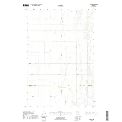
2019 Map of Ulen NW
USGS Topo · Published 2019About this map
Borup occupies a central position along the western edge of this agricultural landscape at the border of Norman and Clay counties. The terrain is defined by the meandering course of the S Br Wild Rice River, which winds through the southern sections of the quadrangle, influencing the local drainage patterns and field layouts. This area of western Minnesota is marked by a strict grid of section lines and county roads, reflecting a highly organized farming economy.
Find a feature on this map
30 named features on this map. Tap any name to fly to it.
Don’t see what you’re looking for? This feature index may not catch every label — zoom into the map to look around manually.
Map Details
Editions of this 2019 Ulen NW Map
This is the sole edition of this map. No revisions or reprints were ever made.
Other maps of this area

1918 · Twin Valley
USGS Topo · 1:62,500

1918 · Ulen
USGS Topo · 1:62,500

1924 · Ada
USGS Topo · 1:62,500

1952 · Grand Forks
USGS Topo · 1:250,000

1956 · Grand Forks
USGS Topo · 1:250,000

1965 · Twin Valley SW
USGS Topo · 1:24,000

1965 · Twin Valley
USGS Topo · 1:24,000

1965 · Syre
USGS Topo · 1:24,000
1965 · Ada
USGS Topo · 1:24,000
1965 · Ulen NW
USGS Topo · 1:24,000