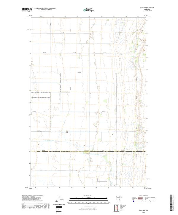
2022 Map of Ulen NW
USGS Topo · Published 2022About this map
Borup sits at the intersection of Co Rd 39 and the local grid, anchoring a landscape defined by the meticulous section lines of the Public Land Survey System. The transition from Norman County to Clay County is marked by 100th Ave, a horizontal boundary that cuts through the southern portion of the map. This area of the Red River Valley shows a high concentration of agricultural infrastructure, with a dense network of numbered roads like 300th St and 110th Ave providing access to the fertile fields.
Find a feature on this map
30 named features on this map. Tap any name to fly to it.
Don’t see what you’re looking for? This feature index may not catch every label — zoom into the map to look around manually.
Map Details
Editions of this 2022 Ulen NW Map
This is the sole edition of this map. No revisions or reprints were ever made.
Other maps of this area

1918 · Twin Valley
USGS Topo · 1:62,500

1918 · Ulen
USGS Topo · 1:62,500

1924 · Ada
USGS Topo · 1:62,500

1952 · Grand Forks
USGS Topo · 1:250,000

1956 · Grand Forks
USGS Topo · 1:250,000

1965 · Twin Valley SW
USGS Topo · 1:24,000

1965 · Twin Valley
USGS Topo · 1:24,000

1965 · Syre
USGS Topo · 1:24,000
1965 · Ada
USGS Topo · 1:24,000
1965 · Ulen NW
USGS Topo · 1:24,000