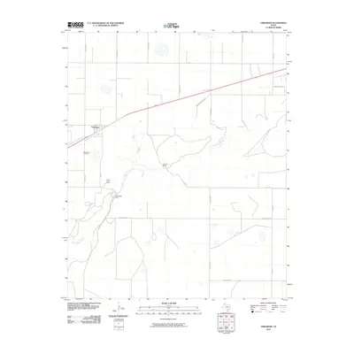
2010 Map of Umbarger
USGS Topo · Published 2010About this map
The community of Umbarger serves as the focal point of this high-plains landscape, situated at the intersection of FM 168 and a major rail corridor. This region of Randall County is defined by the winding course of Tierra Blanca Creek, which snakes eastward through the southern half of the quadrangle. The hydrology of the area is further modified by the Umbarger Dam, creating a significant water feature in an otherwise arid grazing and agricultural environment.
Find a feature on this map
21 named features on this map. Tap any name to fly to it.
Don’t see what you’re looking for? This feature index may not catch every label — zoom into the map to look around manually.
Map Details
Editions of this 2010 Umbarger Map
This is the sole edition of this map. No revisions or reprints were ever made.
Other maps of this area

1954 · Tucumcari
USGS Topo · 1:250,000

1954 · Amarillo
USGS Topo · 1:250,000

1954 · Plainview
USGS Topo · 1:250,000

1954 · Clovis
USGS Topo · 1:250,000

1958 · Clovis
USGS Topo · 1:250,000

1958 · Amarillo
USGS Topo · 1:250,000

1958 · Tucumcari
USGS Topo · 1:250,000

1958 · Plainview
USGS Topo · 1:250,000

1960 · Canyon
USGS Topo · 1:62,500
1960 · Buffalo Stadium
USGS Topo · 1:24,000