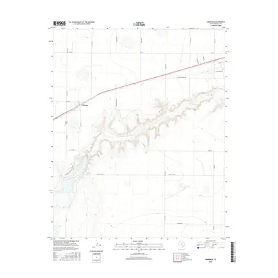
2016 Map of Umbarger
USGS Topo · Published 2016About this map
Umbarger stands as a focal point in this portion of the Texas Panhandle, situated where the high plains meet the intricate drainage system of Tierra Blanca Cr. The landscape transitions from agricultural tablelands into the deeply carved topography surrounding Buffalo Lake, an area preserved with recreational paths like the Shortgrass Prairie Loop Trail. Local history is anchored by Saint Mary's Cem, which serves as a significant genealogical landmark for the community. The map reveals a grid of named rural routes, such as Johnson Ranch Rd and Gordon Cummings Rd, reflecting the ranching and farming heritage of Randall County. The sharp contrast between the flat upland fields and the sudden descent into the creek valley defines the local geography, highlighting how water and erosion have shaped this specific corner of the Llano Estacado.
Find a feature on this map
26 named features on this map. Tap any name to fly to it.
Don’t see what you’re looking for? This feature index may not catch every label — zoom into the map to look around manually.
Map Details
Editions of this 2016 Umbarger Map
This is the sole edition of this map. No revisions or reprints were ever made.
Other maps of this area

1954 · Tucumcari
USGS Topo · 1:250,000

1954 · Amarillo
USGS Topo · 1:250,000

1954 · Plainview
USGS Topo · 1:250,000

1954 · Clovis
USGS Topo · 1:250,000

1958 · Clovis
USGS Topo · 1:250,000

1958 · Amarillo
USGS Topo · 1:250,000

1958 · Tucumcari
USGS Topo · 1:250,000

1958 · Plainview
USGS Topo · 1:250,000

1960 · Canyon
USGS Topo · 1:62,500
1960 · Buffalo Stadium
USGS Topo · 1:24,000