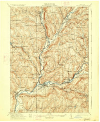
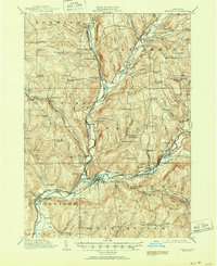
1918 Map of Unadilla
USGS Topo · Published 1927About this map
Susquehanna River and Unadilla River valleys serve as the primary corridors for settlement and transport in this 1915 survey. The topography is defined by the convergence of major water bodies at Sidney, where the New York Ontario and Western RR facilitates a bustling river-and-rail economy. This network connects manufacturing and agricultural hubs like Rockwells Mills and Mount Upton with larger village centers. The map provides a dense record of early 20th-century rural infrastructure, preserving the locations of numerous district schools such as Shumway Hill School and Warner School. Cultural landmarks like the Friends Meeting House in Rogers Hollow sit among a landscape of family-named corners and settlements, including Heslops Corner and Lathams Corners. The boundary between Chenango Co and Otsego Co follows the winding course of the Unadilla River, highlighting how natural watercourses historically defined political divisions in upstate New York.
Find a feature on this map
101 named features on this map. Tap any name to fly to it.
Don’t see what you’re looking for? This feature index may not catch every label — zoom into the map to look around manually.
Map Details
Editions of this 1918 Unadilla Map
6 editions found

Other maps of this area

1902 · Coventry
USGS Topo · 1:62,500

1903 · Norwich
USGS Topo · 1:62,500

1904 · Oxford
USGS Topo · 1:62,500

1905 · Nineveh
USGS Topo · 1:62,500

1910 · Hartwick
USGS Topo · 1:62,500

1910 · New Berlin
USGS Topo · 1:62,500

1912 · New Berlin
USGS Topo · 1:62,500

1912 · Hartwick
USGS Topo · 1:62,500

1915 · Oneonta
USGS Topo · 1:62,500

1915 · Unadilla
USGS Topo · 1:62,500