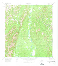
1952 Map of Unalakleet A-4
USGS Topo · Published 1975About this map
The Anvik River dominates the central corridor of this interior landscape, winding through terrain that was photogrammetrically mapped in the early 1950s. This drainage system is fed by significant tributaries including the Swift River to the west and Runkels Creek to the south. In the northern reaches, the waters of Otter Creek and Canyon Creek carve through the high ground, illustrating a complex network of undeveloped waterways. This map represents a moment in time when the region remained largely without roads or trails, as noted by the Army Map Service in their technical classification. The survey also marks the South Boundary Kateel River Meridian, a critical reference point for the unsurveyed and unmarked land lines predetermined by the Bureau of Land Management during this era.
Find a feature on this map
6 named features on this map. Tap any name to fly to it.
Don’t see what you’re looking for? This feature index may not catch every label — zoom into the map to look around manually.
Map Details
Editions of this 1952 Unalakleet A-4 Map
2 editions found
Other maps of this area

1951 · Unalakleet
USGS Topo · 1:250,000

1951 · Holy Cross
USGS Topo · 1:250,000

1952 · Unalakleet A-4
USGS Topo · 1:63,360

1952 · Unalakleet A-3
USGS Topo · 1:63,360

1952 · Unalakleet A-5
USGS Topo · 1:63,360

1952 · Unalakleet B-4
USGS Topo · 1:63,360

1952 · Holy Cross D-5
USGS Topo · 1:63,360

1952 · Holy Cross D-4
USGS Topo · 1:63,360

1952 · Holy Cross D-3
USGS Topo · 1:63,360

1952 · Unalakleet B-3
USGS Topo · 1:63,360