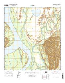
2015 Map of Unalakleet B-1 NW
USGS Topo · Published 2015About this map
The Yukon River dominates this interior landscape, carving a wide path through the Unalakleet B-1 NW quadrangle. In this 2015 study, the river's complex braided nature is evident, particularly where it surrounds Blackburn Island. This large landform within the main channel suggests a dynamic river system where shifting currents and silt deposits constantly reshape the navigation and habitat. The hydrology of the region is further defined by several tributaries, including the meandering Papa Willie Creek and Woods Cr, which flow from the surrounding elevations to meet the primary waterway. The map provides a precise look at the Public Land Survey System grid, including townships t23s r4w and t24s r4w, which is essential for understanding land divisions in this part of the Yukon-Koyukuk region.
Find a feature on this map
8 named features on this map. Tap any name to fly to it.
Don’t see what you’re looking for? This feature index may not catch every label — zoom into the map to look around manually.
Map Details
Editions of this 2015 Unalakleet B-1 NW Map
This is the sole edition of this map. No revisions or reprints were ever made.
Other maps of this area

1951 · Unalakleet
USGS Topo · 1:250,000

1952 · Unalakleet C-2
USGS Topo · 1:63,360

1952 · Unalakleet C-1
USGS Topo · 1:63,360

1952 · Unalakleet B-2
USGS Topo · 1:63,360

1952 · Unalakleet B-1
USGS Topo · 1:63,360

1952 · Unalakleet
USGS Topo · 1:250,000

1964 · Unalakleet
USGS Topo · 1:250,000
2015 · Unalakleet B-2 SE
USGS Topo · 1:25,000
2015 · Unalakleet C-1 SE
USGS Topo · 1:25,000
2015 · Unalakleet C-1 SW
USGS Topo · 1:25,000