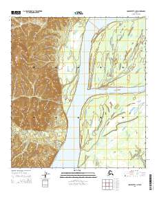
2015 Map of Unalakleet C-1 NW
USGS Topo · Published 2015About this map
The Yukon River dominates this landscape in the western interior of Alaska, carving a wide path through a complex network of wetlands and islands. The river is flanked to the west by the rising elevations of the Nulato Hills, where the terrain transitions sharply from the alluvial floodplain to dissected ridges and valleys. This map captures a vast hydrologic system of seasonal water movement, marked by the presence of Honeymoon Slough and Kinsell Slough, which bypass the main channel and create isolated landmasses such as Bullfrog Island. Drainage from the upland hills is carried by small tributaries like Jenson Creek and Bear Cr as they descend toward the Yukon. The lack of man-made infrastructure or settlements in this 2015 study highlights the enduring wilderness character of the region, where the shifting river channels and seasonal sloughs remain the primary geographic drivers.
Find a feature on this map
13 named features on this map. Tap any name to fly to it.
Don’t see what you’re looking for? This feature index may not catch every label — zoom into the map to look around manually.
Map Details
Editions of this 2015 Unalakleet C-1 NW Map
This is the sole edition of this map. No revisions or reprints were ever made.
Other maps of this area

1951 · Unalakleet
USGS Topo · 1:250,000

1952 · Unalakleet C-2
USGS Topo · 1:63,360

1952 · Unalakleet D-2
USGS Topo · 1:63,360

1952 · Unalakleet C-1
USGS Topo · 1:63,360

1952 · Unalakleet D-1
USGS Topo · 1:63,360

1952 · Unalakleet
USGS Topo · 1:250,000

1964 · Unalakleet
USGS Topo · 1:250,000
2015 · Unalakleet C-2 NE
USGS Topo · 1:25,000
2015 · Unalakleet C-1 SE
USGS Topo · 1:25,000
2015 · Unalakleet C-1 NE
USGS Topo · 1:25,000