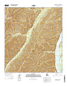
2015 Map of Unalakleet C-2 SE
USGS Topo · Published 2015About this map
The Yukon River dominates the eastern boundary of this Alaskan landscape, defining the edge of a region marked by extensive elevation changes and remote riverine features. This 2015 survey illustrates the path of the river as it flows past Eagle Island, a prominent landform situated within the channel that would have been a critical waypoint for river navigation and local subsistence activities. The terrain rises sharply to the west of the riverbank, where the map details a series of high ridges and drainage patterns that characterize the interior wilderness. The absence of roads or established settlements on this sheet highlights the primary role of the river as the historical and contemporary corridor for movement through this part of the Yukon-Koyukuk region.
Find a feature on this map
11 named features on this map. Tap any name to fly to it.
Don’t see what you’re looking for? This feature index may not catch every label — zoom into the map to look around manually.
Map Details
Editions of this 2015 Unalakleet C-2 SE Map
This is the sole edition of this map. No revisions or reprints were ever made.
Other maps of this area

1951 · Unalakleet
USGS Topo · 1:250,000

1952 · Unalakleet C-2
USGS Topo · 1:63,360

1952 · Unalakleet C-1
USGS Topo · 1:63,360

1952 · Unalakleet B-2
USGS Topo · 1:63,360

1952 · Unalakleet B-1
USGS Topo · 1:63,360

1952 · Unalakleet
USGS Topo · 1:250,000

1964 · Unalakleet
USGS Topo · 1:250,000
2015 · Unalakleet C-2 NE
USGS Topo · 1:25,000
2015 · Unalakleet C-1 SW
USGS Topo · 1:25,000
2015 · Unalakleet C-2 NW
USGS Topo · 1:25,000