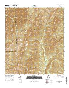
2015 Map of Unalakleet D-2 SE
USGS Topo · Published 2015About this map
The Nulato Hills dominate this portion of the Yukon-Koyukuk Census Area, where the landscape is defined by the complex drainage patterns of the western Alaskan interior. High ridges and steep valleys dictate the course of local waterways, most notably Bear Cr, which winds through the center of the sheet, and Stink Cr in the southeast. The map reveals a wild, unpopulated expanse where natural topography is the primary feature, illustrating the challenging environment that separates the coastal regions from the Yukon River valley. The dense contour lines across the Nulato Hills highlight the significant elevation changes that have historically influenced movement and seasonal activities in this part of the subarctic.
Find a feature on this map
10 named features on this map. Tap any name to fly to it.
Don’t see what you’re looking for? This feature index may not catch every label — zoom into the map to look around manually.
Map Details
Editions of this 2015 Unalakleet D-2 SE Map
This is the sole edition of this map. No revisions or reprints were ever made.
Other maps of this area

1951 · Unalakleet
USGS Topo · 1:250,000

1952 · Unalakleet C-2
USGS Topo · 1:63,360

1952 · Unalakleet D-2
USGS Topo · 1:63,360

1952 · Unalakleet C-1
USGS Topo · 1:63,360

1952 · Unalakleet D-1
USGS Topo · 1:63,360

1952 · Unalakleet
USGS Topo · 1:250,000

1964 · Unalakleet
USGS Topo · 1:250,000
2015 · Unalakleet C-2 NE
USGS Topo · 1:25,000
2015 · Unalakleet D-2 SW
USGS Topo · 1:25,000
2015 · Unalakleet C-2 NW
USGS Topo · 1:25,000