
1990 Map of Unalaska C-2
USGS Topo · Published 1990About this map
Unalaska and Dutch Harbor serve as the focal points of this Aleutian landscape, situated where the deep waters of Dutch Harbor and Iliuliuk Harbor meet the rugged terrain of Amaknak Island. The map illustrates a developed maritime and aviation hub, featuring a Landing Strip, a Seawall, and numerous Tanks supporting the local economy. Civil life is anchored by the City Hall and Post Office, while the surrounding geography is defined by prominent peaks like Mount Ballyhoo and Pyramid Peak. This 1990 provisional edition provides a detailed look at the infrastructure and coastal features before the turn of the century, including US Survey 58 markers and local landmarks such as Agnes Beach and Iliuliuk Reef. Small waterways like the Nateekin River and Iliuliuk River drain the mountainous interior into the expansive Beaver Inlet.
Find a feature on this map
68 named features on this map. Tap any name to fly to it.
Don’t see what you’re looking for? This feature index may not catch every label — zoom into the map to look around manually.
Map Details
Editions of this 1990 Unalaska C-2 Map
2 editions found
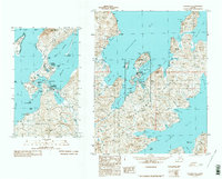
Other maps of this area

1951 · Unalaska
USGS Topo · 1:250,000
1989 · Unalaska B-1
USGS Topo · 1:63,360

1989 · Unalaska C-3
USGS Topo · 1:63,360
1989 · Unalaska D-1
USGS Topo · 1:63,360
1989 · Unalaska D-3
USGS Topo · 1:63,360
1989 · Unalaska D-2
USGS Topo · 1:63,360
1989 · Unalaska C-1
USGS Topo · 1:63,360

1989 · Unalaska B-2
USGS Topo · 1:63,360

1989 · Unalaska B-3
USGS Topo · 1:63,360
2020 · Unalaska D-1 SW
USGS Topo · 1:25,000