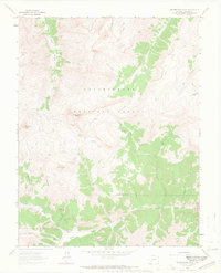
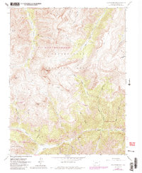
1963 Map of Uncompahgre Peak
USGS Topo · Published 1966About this map
Capitol City (Site) stands as a primary historical landmark in this high-altitude landscape within the Uncompahgre National Forest. During the early 1960s, the area remained a center for exploration and legacy mining, evidenced by the numerous operations concentrated along the drainages of Henson Creek and Yellowstone Gulch. Named mines such as the Pride of America Mine, Czarina Mine, and Henson Mine indicate the intense geological interest in the gulches surrounding the 14,000-foot summit of Uncompahgre Peak. The terrain is defined by dramatic elevation changes, with Matterhorn Peak and Silver Mountain towering over a network of watercourses including the Little Cimarron River and Big Blue Creek. A complex system of a Jeep Trail and a Stock Driveway suggests the dual use of these peaks for both resource extraction and seasonal grazing during this era.
Find a feature on this map
37 named features on this map. Tap any name to fly to it.
Don’t see what you’re looking for? This feature index may not catch every label — zoom into the map to look around manually.
Map Details
Editions of this 1963 Uncompahgre Peak Map
5 editions found
Other maps of this area

1897 · Silverton
USGS Topo · 1:62,500

1901 · Silverton
USGS Topo · 1:62,500

1902 · Silverton
USGS Topo · 1:62,500

1902 · Ouray
USGS Topo · 1:62,500

1903 · Lake City
USGS Topo · 1:62,500

1904 · Ouray
USGS Topo · 1:62,500

1905 · Lake City
USGS Topo · 1:62,500

1905 · San Cristobal
USGS Topo · 1:125,000

1907 · San Cristobal
USGS Topo · 1:125,000

1908 · Uncompahgre
USGS Topo · 1:125,000