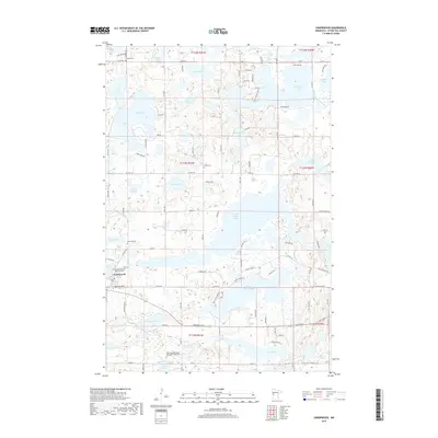
2019 Map of Underwood
USGS Topo · Published 2019About this map
Underwood serves as the central hub of this Otter Tail County landscape, where the prairie meets an intricate network of glacial lakes and rivers. The settlement's cultural history is marked by several dedicated burial grounds, including the Sunset Memorial Unitarian Cem and the Norwegian Methodist Episcopal Church Cem, reflecting the area's diverse denominational roots. The terrain is dominated by significant water bodies such as North Turtle Lake and South Turtle Lake, which are part of a complex hydrologic system that includes the Otter Tail River to the north and the Pomme de Terre River to the south.
Find a feature on this map
74 named features on this map. Tap any name to fly to it.
Don’t see what you’re looking for? This feature index may not catch every label — zoom into the map to look around manually.
Map Details
Editions of this 2019 Underwood Map
This is the sole edition of this map. No revisions or reprints were ever made.
Other maps of this area

1912 · Battle Lake
USGS Topo · 1:62,500

1913 · Ashby
USGS Topo · 1:62,500

1914 · Battle Lake
USGS Topo · 1:62,500

1915 · Underwood
USGS Topo · 1:62,500

1953 · Brainerd
USGS Topo · 1:250,000

1957 · Brainerd
USGS Topo · 1:250,000

1958 · Brainerd
USGS Topo · 1:250,000

1965 · Brainerd
USGS Topo · 1:250,000

1969 · Eagle Lake
USGS Topo · 1:24,000
1973 · Battle Lake
USGS Topo · 1:24,000
Featured Places
- Underwood, MN
- Everts Township, MN
- Tordenskjold Township, MN
- Clitherall Township, MN
- Sverdrup Township, MN