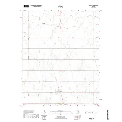
2018 Map of Union City
USGS Topo · Published 2018About this map
Union City serves as a central hub on this 2018 survey, positioned at the intersection of long-established section-line roads and the north-south corridor of Highway 81. The landscape is characterized by its organized grid, which connects the southern portion of El Reno to smaller points like Powers and Minco. Water features such as Arapaho Cr and Sixmile Cr weave through the agricultural divisions, providing natural relief to the geometric survey lines. For family history researchers, the map identifies key burial sites including Union City Cem, Saint Josephs Cem, and Pleasant View Cem, which anchor the rural community centers. To the north, the Baker Airstrip and the 017001 Reservoir highlight the varied land use across the Canadian Co and Grady Co border. The map preserves the specific road nomenclature of the era, from named paths like Reuter Rd E and Jensen Rd E to the precise numbering of the township and range system.
Find a feature on this map
61 named features on this map. Tap any name to fly to it.
Don’t see what you’re looking for? This feature index may not catch every label — zoom into the map to look around manually.
Map Details
Editions of this 2018 Union City Map
This is the sole edition of this map. No revisions or reprints were ever made.
Other maps of this area

1892 · Kingfisher
USGS Topo · 1:125,000

1893 · Fort Reno
USGS Topo · 1:62,500

1893 · Buggy Creek
USGS Topo · 1:62,500

1893 · Minco
USGS Topo · 1:62,500

1895 · Kingfisher
USGS Topo · 1:125,000

1904 · Chickasha
USGS Topo · 1:125,000

1941 · Fort Reno
USGS Topo · 1:62,500

1942 · Fort Reno
USGS Topo · 1:62,500

1949 · Fort Reno
USGS Topo · 1:62,500

1954 · Oklahoma City
USGS Topo · 1:250,000