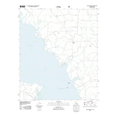
2010 Map of Union Springs
USGS Topo · Published 2010About this map
The eastern shores of the Toledo Bend Reservoir define this landscape, where the inundated river valley meets the rising terrain of the Texas-Louisiana borderlands. Near the settlement of Union Springs, a complex network of small waterways like Bossier Bayou and Moccasin Bayou drain toward the massive reservoir. The map reveals distinct ecological and topographical markers, including the open spaces of Racetrack Prairie and Gravel Prairie, alongside prominent elevations such as Sand Hill and Big Hill.
Find a feature on this map
48 named features on this map. Tap any name to fly to it.
Don’t see what you’re looking for? This feature index may not catch every label — zoom into the map to look around manually.
Map Details
Editions of this 2010 Union Springs Map
This is the sole edition of this map. No revisions or reprints were ever made.
Other maps of this area

1941 · Zwolle
USGS Topo · 1:62,500

1941 · Pelican
USGS Topo · 1:62,500

1943 · Pleasant Hill
USGS Topo · 1:62,500

1944 · Logansport
USGS Topo · 1:62,500

1944 · Patroon
USGS Topo · 1:62,500

1944 · Zwolle
USGS Topo · 1:62,500

1944 · Pleasant Hill
USGS Topo · 1:62,500

1953 · Alexandria
USGS Topo · 1:250,000

1955 · Alexandria
USGS Topo · 1:250,000

1956 · Logansport
USGS Topo · 1:62,500