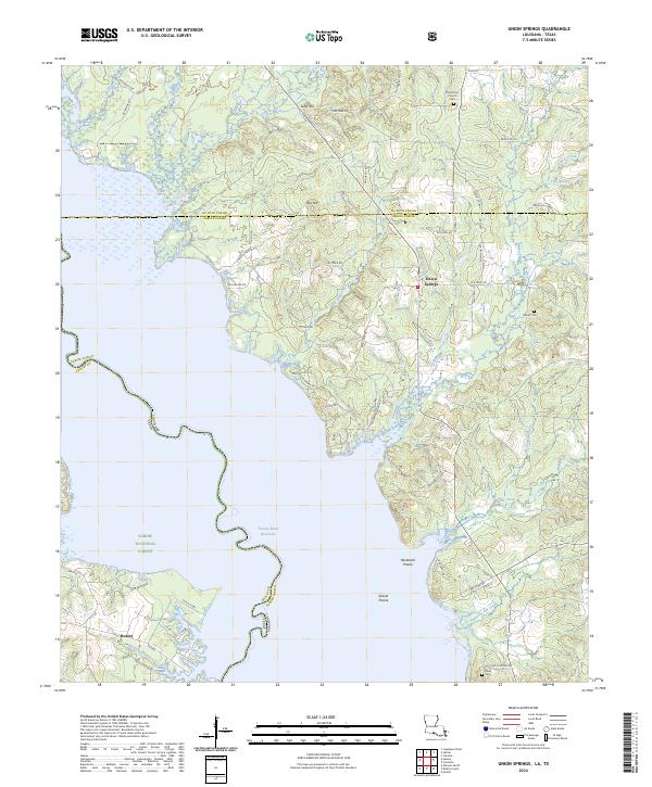
2024 Map of Union Springs
USGS Topo · Published 2024About this map
The Toledo Bend Reservoir dominates this borderland landscape, where the waters of the Sabine River divide Louisiana and Texas. On the eastern shore in Sabine Parish, the small settlement of Union Springs sits near the winding course of Bossier Bayou and Prairie Creek. The terrain is defined by distinct elevations like Sand Hill and Big Hill, while specialized ecological zones such as Racetrack Prairie and Gravel Prairie appear near the southern reaches of the reservoir. To the west, the community of Huxley marks the edge of the Sabine National Forest in Shelby County. This modern survey provides precise locations for family history markers including Oak Grove Church Cem, Bossier Cem, and Pauls Cem, reflecting the deep-rooted rural congregations that have long inhabited these timberlands and bayous.
Find a feature on this map
75 named features on this map. Tap any name to fly to it.
Don’t see what you’re looking for? This feature index may not catch every label — zoom into the map to look around manually.
Map Details
Editions of this 2024 Union Springs Map
This is the sole edition of this map. No revisions or reprints were ever made.
Other maps of this area

1941 · Zwolle
USGS Topo · 1:62,500

1941 · Pelican
USGS Topo · 1:62,500

1943 · Pleasant Hill
USGS Topo · 1:62,500

1944 · Logansport
USGS Topo · 1:62,500

1944 · Patroon
USGS Topo · 1:62,500

1944 · Zwolle
USGS Topo · 1:62,500

1944 · Pleasant Hill
USGS Topo · 1:62,500

1953 · Alexandria
USGS Topo · 1:250,000

1955 · Alexandria
USGS Topo · 1:250,000

1956 · Logansport
USGS Topo · 1:62,500