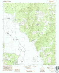
1984 Map of Union Springs
USGS Topo · Published 1984About this map
The Sabine River border between Louisiana and Texas is dominated by the sprawling waters of the Toledo Bend Reservoir, which flooded this river valley in the late 1960s. This 1984 survey reveals how the rising water reshaped the landscape of Sabine Parish, creating a complex shoreline of inlets and peninsulas where bayous like Bossier Bayou and Moccasin Bayou meet the main reservoir. The map is particularly notable for its documentation of colonial-era land divisions, clearly delineating the boundaries of the Las Ormigas Grant Lot No 4 and subsequent lots, which persist as legal frameworks long after the initial Spanish-influenced settlement patterns were established.
Find a feature on this map
26 named features on this map. Tap any name to fly to it.
Don’t see what you’re looking for? This feature index may not catch every label — zoom into the map to look around manually.
Map Details
Editions of this 1984 Union Springs Map
This is the sole edition of this map. No revisions or reprints were ever made.
Other maps of this area

1941 · Zwolle
USGS Topo · 1:62,500

1941 · Pelican
USGS Topo · 1:62,500

1943 · Pleasant Hill
USGS Topo · 1:62,500

1944 · Logansport
USGS Topo · 1:62,500

1944 · Patroon
USGS Topo · 1:62,500

1944 · Zwolle
USGS Topo · 1:62,500

1944 · Pleasant Hill
USGS Topo · 1:62,500

1953 · Alexandria
USGS Topo · 1:250,000

1955 · Alexandria
USGS Topo · 1:250,000

1956 · Logansport
USGS Topo · 1:62,500