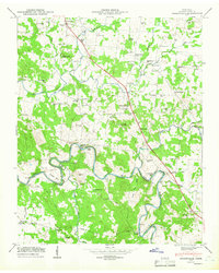
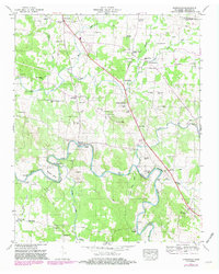
1947 Map of Unionville
USGS Topo · Published 1966About this map
Unionville serves as the central hub for this rural portion of Bedford County, where agricultural lands are defined by a complex network of waterways. The settlement at Poplins Crossroads and the surrounding homesteads are deeply tied to the drainage patterns of Weakly Creek and the North Fork Creek. This Tennessee Valley Authority field examination from the late 1940s captures a landscape of small-scale crossings and winding roads that follow the natural contours of the North Fork. The map reflects an era of established rural communities where the proximity to freshwater sources dictated the placement of roads and residential clusters before the expansion of modern highway systems changed the pace of local travel.
Find a feature on this map
5 named features on this map. Tap any name to fly to it.
Don’t see what you’re looking for? This feature index may not catch every label — zoom into the map to look around manually.
Map Details
Editions of this 1947 Unionville Map
5 editions found
Other maps of this area

1936 · Chapel Hill
USGS Topo · 1:24,000

1936 · Farmington
USGS Topo · 1:24,000

1936 · Shelbyville
USGS Topo · 1:24,000

1936 · Rover
USGS Topo · 1:24,000

1936 · Belfast
USGS Topo · 1:24,000

1936 · Deason
USGS Topo · 1:24,000

1936 · Unionville
USGS Topo · 1:24,000

1936 · Bedford
USGS Topo · 1:24,000

1936 · Fosterville
USGS Topo · 1:24,000

1944 · Shelbyville
USGS Topo · 1:100,000