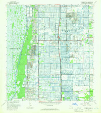
1962 Map of University Park
USGS Topo · Published 1966About this map
Loxahatchee National Wildlife Refuge dominates the western landscape of this Palm Beach County area in the early 1960s, defined by the extensive Conservation Area No 1. This wilderness contrasts sharply with the meticulously gridded agricultural and residential development to the east, where the Sunshine State Parkway (Toll) serves as a primary north-south artery. The map captures an era of expansion for communities like University-Park and County Club Acres, while showing the early institutional footprint of the St Andrews Preparatory Sch. The presence of small settlements like Dewitt and localized facilities such as the Hagen Sch and a rural Landing Strip reflect a transitional period before the region's more intensive suburbanization. Water management is a central theme, evidenced by the numerous canals and a Gaging Station positioned along the refuge boundary.
Find a feature on this map
26 named features on this map. Tap any name to fly to it.
Don’t see what you’re looking for? This feature index may not catch every label — zoom into the map to look around manually.
Map Details
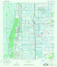
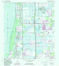
Editions of this 1962 University Park Map
3 editions found
Other maps of this area

1945 · Greenacres City
USGS Topo · 1:24,000

1945 · Lake Worth
USGS Topo · 1:24,000

1946 · West Dixie Bend
USGS Topo · 1:24,000

1946 · Boca Raton
USGS Topo · 1:24,000

1947 · Delmar Farms
USGS Topo · 1:24,000

1949 · Lake Worth
USGS Topo · 1:24,000

1949 · West Dixie Bend
USGS Topo · 1:24,000

1949 · Delmar Farms
USGS Topo · 1:24,000

1950 · Boca Raton
USGS Topo · 1:24,000

1950 · Delray Beach
USGS Topo · 1:24,000