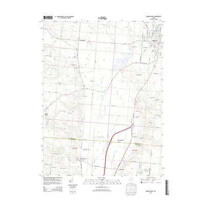
2013 Map of Urbana West
USGS Topo · Published 2013About this map
Urbana and its western rural surroundings are defined by the wide corridor of the Mad River, which bisects this landscape from north to south. The western reaches of the city host Urbana Univ and the Mad River-Inc Airport, reflecting the area's development as an educational and transit hub. To the west, the terrain rises into the highlands above the river valley, where small rural settlements like Westville, Terre Haute, and Gentis Farms are scattered among a network of family and community cemeteries, including Nettle Creek Cem, Snider Cem, and Shockey Cem.
Find a feature on this map
105 named features on this map. Tap any name to fly to it.
Don’t see what you’re looking for? This feature index may not catch every label — zoom into the map to look around manually.
Map Details
Editions of this 2013 Urbana West Map
This is the sole edition of this map. No revisions or reprints were ever made.
Other maps of this area

1904 · Springfield
USGS Topo · 1:62,500

1906 · Springfield
USGS Topo · 1:62,500

1907 · South Charleston
USGS Topo · 1:62,500

1914 · St. Paris
USGS Topo · 1:62,500

1914 · Mechanicsburg
USGS Topo · 1:62,500

1916 · Mechanicsburg
USGS Topo · 1:62,500

1916 · St. Paris
USGS Topo · 1:62,500

1944 · Mechanicsburg
USGS Topo · 1:62,500

1944 · St. Paris
USGS Topo · 1:62,500

1947 · Columbus
USGS Topo · 1:250,000