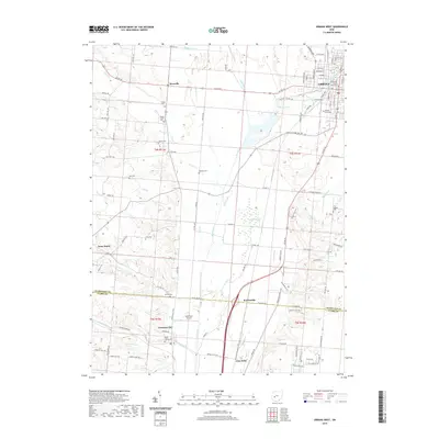
2019 Map of Urbana West
USGS Topo · Published 2019About this map
Urbana and its western rural hinterlands are defined by the winding course of the Mad River, which cuts a broad valley through the center of this landscape. The city itself, serving as the seat of government, is anchored by the Champaign County Courthouse and the historic campus of Urbana University. Moving west across the valley, the terrain transitions from the concentrated grid of the city to a mosaic of agricultural sections and natural bottomlands. The presence of the Cedar Swamp along the eastern bank of the river suggests the unique hydrologic conditions of the region, while the Mad River Airpark reflects the continued utility of the flat valley floor for transportation. Numerous family and community burial grounds, such as Snider Cem, Nettle Creek Cem, and Rector Cem, are scattered across the townships, providing a clear map of early settlement patterns near small communities like Westville and Tremont City.
Find a feature on this map
67 named features on this map. Tap any name to fly to it.
Don’t see what you’re looking for? This feature index may not catch every label — zoom into the map to look around manually.
Map Details
Editions of this 2019 Urbana West Map
This is the sole edition of this map. No revisions or reprints were ever made.
Other maps of this area

1904 · Springfield
USGS Topo · 1:62,500

1906 · Springfield
USGS Topo · 1:62,500

1907 · South Charleston
USGS Topo · 1:62,500

1914 · St. Paris
USGS Topo · 1:62,500

1914 · Mechanicsburg
USGS Topo · 1:62,500

1916 · Mechanicsburg
USGS Topo · 1:62,500

1916 · St. Paris
USGS Topo · 1:62,500

1944 · Mechanicsburg
USGS Topo · 1:62,500

1944 · St. Paris
USGS Topo · 1:62,500

1947 · Columbus
USGS Topo · 1:250,000