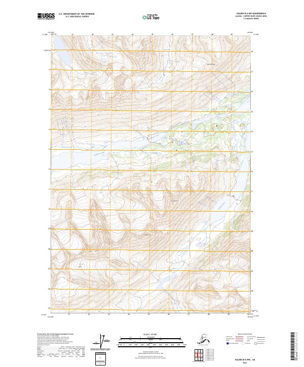
2023 Map of Valdez B-6 NW
USGS Topo · Published 2023About this map
The Klutina River flows through the southeastern portion of this landscape, carving through the high elevations of the Copper River Census Area. This interior Alaskan terrain is dominated by prominent summits, including Garrett Peak in the northeast and Mt Ourand further south. The drainage patterns are defined by high-altitude glacial runoff, most notably from Stephens Creek, which winds through the central sections of the survey. Topographical data from the U.S. Geological Survey illustrates the steep gradients and remote character of these peaks, with Mt Evans standing as a primary landmark in the southern reaches. The map reflects a wilderness area largely devoid of modern road infrastructure, preserving the natural flow of its glacial waterways and the sheer verticality of its mountain ranges.
Find a feature on this map
11 named features on this map. Tap any name to fly to it.
Don’t see what you’re looking for? This feature index may not catch every label — zoom into the map to look around manually.
Map Details
Editions of this 2023 Valdez B-6 NW Map
This is the sole edition of this map. No revisions or reprints were ever made.
Other maps of this area

1950 · Valdez C-6
USGS Topo · 1:63,360

1951 · Valdez B-6
USGS Topo · 1:63,360

1952 · Valdez
USGS Topo · 1:250,000

1953 · Valdez C-6
USGS Topo · 1:63,360

1953 · Valdez B-6
USGS Topo · 1:63,360

1960 · Valdez B-7
USGS Topo · 1:63,360

1960 · Valdez C-7
USGS Topo · 1:63,360

1960 · Valdez
USGS Topo · 1:250,000
1993 · Valdez C-6
USGS Topo · 1:63,360
1993 · Valdez C-7
USGS Topo · 1:63,360