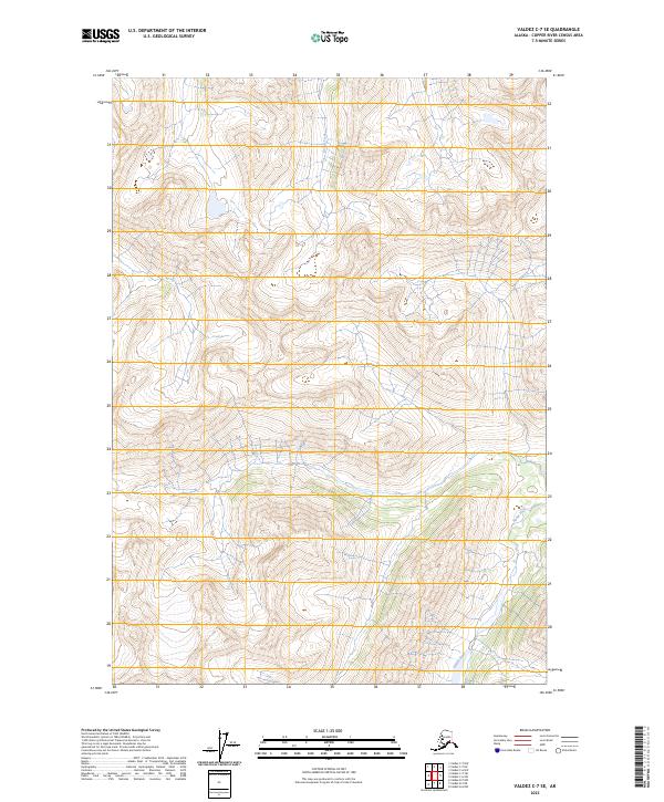
2023 Map of Valdez C-7 SE
USGS Topo · Published 2023About this map
Hallet River and Kaina Creek drain this wilderness corridor within the Copper River Census Area, where steep mountainous terrain defines the landscape. This 2023 survey by the U.S. Geological Survey details the complex topography of the Valdez C-7 SE region, illustrating a remote portion of the Alaska Range where elevation changes are sharp and water bodies are the primary named landmarks. The grid system established by t3s r7w, t3s r6w, t4s r7w, and t4s r6w provides the structural framework for this largely undeveloped territory, offering a precise look at the drainage patterns of the upper Hallet River system.
Find a feature on this map
6 named features on this map. Tap any name to fly to it.
Don’t see what you’re looking for? This feature index may not catch every label — zoom into the map to look around manually.
Map Details
Editions of this 2023 Valdez C-7 SE Map
This is the sole edition of this map. No revisions or reprints were ever made.
Other maps of this area

1950 · Valdez C-6
USGS Topo · 1:63,360

1951 · Valdez B-6
USGS Topo · 1:63,360

1952 · Valdez
USGS Topo · 1:250,000

1953 · Valdez C-6
USGS Topo · 1:63,360

1953 · Valdez B-6
USGS Topo · 1:63,360

1960 · Valdez B-7
USGS Topo · 1:63,360

1960 · Valdez C-7
USGS Topo · 1:63,360

1960 · Valdez
USGS Topo · 1:250,000
1993 · Valdez C-6
USGS Topo · 1:63,360
1993 · Valdez C-7
USGS Topo · 1:63,360