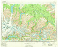
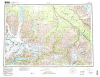
1960 Map of Valdez
USGS Topo · Published 1969About this map
Valdez sits at the southern edge of this vast survey, serving as a vital coastal link where the Richardson Highway begins its northward climb toward the interior. The landscape is defined by the massive glacial systems of the Chugach Mountains, including the Nelchina Glacier and Tazlina Glacier, which feed the complex river networks of the Copper River basin. Further north and east, the Edgerton Highway connects the settlements of Tonsina and Chitina, tracing a path through a region where the industrial legacy of copper mining once thrived. Significant water bodies like Tazzlina Lake and Klutina Lake dominate the central valleys, while high peaks such as Mount Carter and Mount Dimond mark the rugged interior. This map records the established transportation corridors and small outposts like Copper Center and Tiekel Cache that supported travel and commerce in the mid-20th century before significant modern expansion.
Find a feature on this map
72 named features on this map. Tap any name to fly to it.
Don’t see what you’re looking for? This feature index may not catch every label — zoom into the map to look around manually.
Map Details
Editions of this 1960 Valdez Map
6 editions found

Other maps of this area

1948 · Cordova
USGS Topo · 1:250,000

1948 · Valdez D-5
USGS Topo · 1:63,360

1948 · Anchorage D-1
USGS Topo · 1:63,360

1949 · Gulkana A-3
USGS Topo · 1:63,360

1949 · Gulkana A-5
USGS Topo · 1:63,360

1949 · Talkeetna Mountains A-1
USGS Topo · 1:63,360

1949 · Valdez D-4
USGS Topo · 1:63,360

1949 · Gulkana A-6
USGS Topo · 1:63,360

1949 · Valdez D-8
USGS Topo · 1:63,360

1949 · Valdez D-6
USGS Topo · 1:63,360