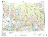
1960 Map of Valdez
USGS Topo · Published 1986About this map
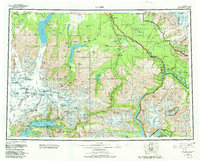
Valdez and the surrounding wilderness of the Chugach Mountains are captured here during a period of transition, following the 1964 earthquake and the subsequent relocation of the townsite. The map distinguishes between the main settlement and Old Valdez, while also documenting the rise of infrastructure with the Trans-Alaska Pipeline and Pump Station 12. To the north, the Richardson Highway connects established communities like Copper Center and Willow Creek, following the corridor of the Copper River.
Find a feature on this map
82 named features on this map. Tap any name to fly to it.
Don’t see what you’re looking for? This feature index may not catch every label — zoom into the map to look around manually.
Map Details
Editions of this 1960 Valdez Map
6 editions found

Other maps of this area

1948 · Cordova
USGS Topo · 1:250,000

1948 · Valdez D-5
USGS Topo · 1:63,360

1948 · Anchorage D-1
USGS Topo · 1:63,360

1949 · Gulkana A-3
USGS Topo · 1:63,360

1949 · Gulkana A-5
USGS Topo · 1:63,360

1949 · Talkeetna Mountains A-1
USGS Topo · 1:63,360

1949 · Valdez D-4
USGS Topo · 1:63,360

1949 · Gulkana A-6
USGS Topo · 1:63,360

1949 · Valdez D-8
USGS Topo · 1:63,360

1949 · Valdez D-6
USGS Topo · 1:63,360