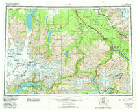
1960 Map of Valdez
USGS Topo · Published 1982About this map
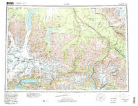
The Copper River and its massive network of glacial tributaries dominate this interior and coastal landscape, spanning the rugged transition from the Gulf of Alaska to the Copper River Basin. The map details the port city of Valdez alongside Old Valdez, reflecting the area's complex settlement history near the Valdez Glacier. This edition records the infrastructure of the late mid-century, including the Trans-Alaska Pipeline and the Copper River and Northwestern Railroad Grade. Along the Richardson Highway, smaller settlements such as Copper Center, Tonsina, and Willow Creek serve as vital hubs. Industrial heritage is noted through the Cliff Mine and Midas Mine, while the vast wilderness of Wrangell-Saint Elias National Park and the Chugach National Forest preserves the natural state of features like Tazlina Lake and the Columbia Glacier.
Find a feature on this map
103 named features on this map. Tap any name to fly to it.
Don’t see what you’re looking for? This feature index may not catch every label — zoom into the map to look around manually.
Map Details
Editions of this 1960 Valdez Map
6 editions found

Other maps of this area

1948 · Cordova
USGS Topo · 1:250,000

1948 · Valdez D-5
USGS Topo · 1:63,360

1948 · Anchorage D-1
USGS Topo · 1:63,360

1949 · Gulkana A-3
USGS Topo · 1:63,360

1949 · Gulkana A-5
USGS Topo · 1:63,360

1949 · Talkeetna Mountains A-1
USGS Topo · 1:63,360

1949 · Valdez D-4
USGS Topo · 1:63,360

1949 · Gulkana A-6
USGS Topo · 1:63,360

1949 · Valdez D-8
USGS Topo · 1:63,360

1949 · Valdez D-6
USGS Topo · 1:63,360