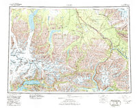
1960 Map of Valdez
USGS Topo · Published 1981About this map
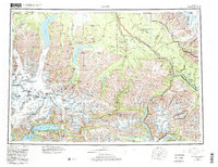
The Trans-Alaska Pipeline and the Richardson Highway corridor anchor this mid-century portrait of a region defined by its monumental ice and shifting transportation networks. Near the southern coast, the Valdez corporate boundary encompasses both the modern city and the site of Old Valdez, while the Marine Terminal stands as a focal point of industrial development at the head of the port. Moving inland, the landscape is a complex system of glaciers, including the massive Columbia Glacier, Tazlina Glacier, and Stephens Glacier.
Find a feature on this map
75 named features on this map. Tap any name to fly to it.
Don’t see what you’re looking for? This feature index may not catch every label — zoom into the map to look around manually.
Map Details
Editions of this 1960 Valdez Map
6 editions found

Other maps of this area

1948 · Cordova
USGS Topo · 1:250,000

1948 · Valdez D-5
USGS Topo · 1:63,360

1948 · Anchorage D-1
USGS Topo · 1:63,360

1949 · Gulkana A-3
USGS Topo · 1:63,360

1949 · Gulkana A-5
USGS Topo · 1:63,360

1949 · Talkeetna Mountains A-1
USGS Topo · 1:63,360

1949 · Valdez D-4
USGS Topo · 1:63,360

1949 · Gulkana A-6
USGS Topo · 1:63,360

1949 · Valdez D-8
USGS Topo · 1:63,360

1949 · Valdez D-6
USGS Topo · 1:63,360