
1941 Map of Valhalla
USGS Topo · Published 1963About this map
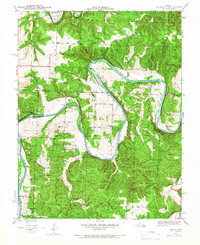
The Osage River dominates this 1941 landscape, winding through a series of dramatic loops including Uda Bend, McGuiness Bend, and Valley Bend. This survey captures the rural character of the region before significant modern development, highlighting a localized economy centered on river access and small rural hubs. The presence of Valhalla P O and Valhalla Store suggests a community center that served the surrounding farmsteads and riverside camps such as Scotts Camp and Eds Camp.
Find a feature on this map
50 named features on this map. Tap any name to fly to it.
Don’t see what you’re looking for? This feature index may not catch every label — zoom into the map to look around manually.
Map Details
Editions of this 1941 Valhalla Map
2 editions found
Other maps of this area

1887 · Clinton
USGS Topo · 1:125,000

1887 · Warsaw
USGS Topo · 1:125,000

1894 · Warsaw
USGS Topo · 1:125,000

1894 · Clinton
USGS Topo · 1:125,000

1936 · Shawnee Bend
USGS Topo · 1:24,000

1939 · Osceola
USGS Topo · 1:24,000

1940 · Osceola
USGS Topo · 1:24,000

1940 · Iconium
USGS Topo · 1:24,000

1941 · Lowry City
USGS Topo · 1:24,000
1944 · Iconium
USGS Topo · 1:24,000