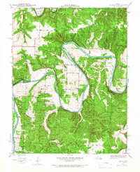
1941 Map of Valhalla
USGS Topo · Published 1966About this map
The winding Osage River and South Grand River dominate this 1941 landscape, carving deep bends and loops through the rural borderlands of Henry, St. Clair, and Benton Counties. This pre-reservoir era survey reveals a riverine economy and society that relied on numerous river crossings, including Greys Mill Ford and Browns Ford. Along the riverbanks, recreational and fishing life is evident at established sites like Scotts Camp, Drennons Camp, and Eds Camp.
Find a feature on this map
43 named features on this map. Tap any name to fly to it.
Don’t see what you’re looking for? This feature index may not catch every label — zoom into the map to look around manually.
Map Details
Editions of this 1941 Valhalla Map
2 editions found
Other maps of this area

1887 · Clinton
USGS Topo · 1:125,000

1887 · Warsaw
USGS Topo · 1:125,000

1894 · Warsaw
USGS Topo · 1:125,000

1894 · Clinton
USGS Topo · 1:125,000

1936 · Shawnee Bend
USGS Topo · 1:24,000

1939 · Osceola
USGS Topo · 1:24,000

1940 · Osceola
USGS Topo · 1:24,000

1940 · Iconium
USGS Topo · 1:24,000

1941 · Valhalla
USGS Topo · 1:24,000

1941 · Lowry City
USGS Topo · 1:24,000