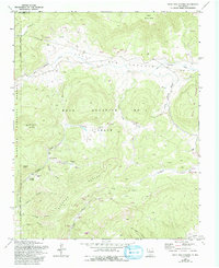
1970 Map of Valle San Antonio
USGS Topo · Published 1993About this map
Valle San Antonio defines this high-elevation landscape within the Santa Fe National Forest, where vast open meadows meet the complex volcanic topography of the Jemez Mountains. The area is characterized by a network of drainage basins, including Valle Seco, Valle Jaramillo, and a portion of the massive Valle Grande. The 1970s marked a period of specialized geological interest here, evidenced by the presence of numerous Geothermal Wells and Geothermal Wells concentrated near Sulphur Springs and along Redondo Creek. These features point to the region's active geothermal history and industrial exploration within the Baca Location No 1 grant. Water is central to the local geography, with San Antonio Creek winding through the meadows and several high-altitude Springs providing vital resources for the scattered Cabins and Corral sites located throughout the canyons and vales.
Find a feature on this map
37 named features on this map. Tap any name to fly to it.
Don’t see what you’re looking for? This feature index may not catch every label — zoom into the map to look around manually.
Map Details
Editions of this 1970 Valle San Antonio Map
Other maps of this area

1890 · Jemes
USGS Topo · 1:125,000

1892 · Jemes
USGS Topo · 1:125,000

1892 · Santa Clara
USGS Topo · 1:125,000

1909 · Gallina
USGS Topo · 1:125,000

1918 · Abiquiu
USGS Topo · 1:125,000

1937 · Jemez Springs
USGS Topo · 1:48,000

1944 · Jemez Springs
USGS Topo · 1:62,500

1952 · Valle Toledo
USGS Topo · 1:24,000

1952 · Jemez Springs
USGS Topo · 1:62,500

1953 · Cerro Del Grant
USGS Topo · 1:24,000