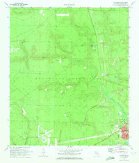
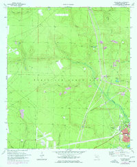
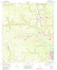
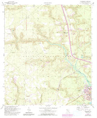
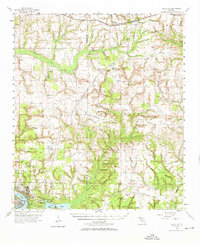
1970 Map of Valparaiso
USGS Topo · Published 1972About this map
Valparaiso and Niceville anchor the southeast corner of this Panhandle landscape, where the town grids meet the expansive Eglin Air Force Base military reservation. The geography is defined by a dense network of watercourses, including Turkey Creek and Juniper Creek, which flow toward Toms Bayou. A significant corridor is formed by the U S Government Railroad, which runs parallel to the Base Line surveying boundary, cutting through the forest and swamp terrain that characterizes much of the reservation.
Find a feature on this map
35 named features on this map. Tap any name to fly to it.
Don’t see what you’re looking for? This feature index may not catch every label — zoom into the map to look around manually.
Map Details
Editions of this 1970 Valparaiso Map
4 editions found
Other maps of this area

1934 · Holt
USGS Topo · 1:48,000

1934 · Niceville
USGS Topo · 1:48,000

1935 · Villa Tasso
USGS Topo · 1:48,000

1936 · Niceville
USGS Topo · 1:62,500

1937 · Holt
USGS Topo · 1:62,500

1938 · Mary Esther
USGS Topo · 1:62,500

1938 · Villa Tasso
USGS Topo · 1:62,500
1956 · Niceville
USGS Topo · 1:62,500
1956 · Fort Walton Beach
USGS Topo · 1:62,500
1956 · Holt
USGS Topo · 1:62,500