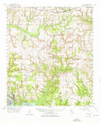
1970 Map of Valparaiso
USGS Topo · Published 1987About this map
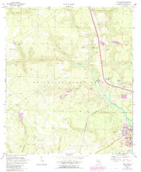
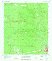
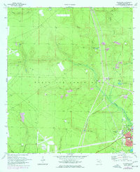
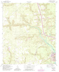
Eglin Air Force Base dominates the landscape of this 1970 survey, revealing the strategic military footprint that reshaped this portion of the Florida Panhandle. The map illustrates a transitional period for the neighboring communities of Niceville and Valparaiso, showing residential expansion along Lincoln Ave and Andrew Dr near Toms Bayou. The presence of Aux Field No 4 (Abandoned) and Aux Field No 5 (Abandoned) provides a look at the evolving aviation needs of the era.
Find a feature on this map
38 named features on this map. Tap any name to fly to it.
Don’t see what you’re looking for? This feature index may not catch every label — zoom into the map to look around manually.
Map Details
Editions of this 1970 Valparaiso Map
4 editions found
Other maps of this area

1934 · Holt
USGS Topo · 1:48,000

1934 · Niceville
USGS Topo · 1:48,000

1935 · Villa Tasso
USGS Topo · 1:48,000

1936 · Niceville
USGS Topo · 1:62,500

1937 · Holt
USGS Topo · 1:62,500

1938 · Mary Esther
USGS Topo · 1:62,500

1938 · Villa Tasso
USGS Topo · 1:62,500
1956 · Niceville
USGS Topo · 1:62,500
1956 · Fort Walton Beach
USGS Topo · 1:62,500
1956 · Holt
USGS Topo · 1:62,500