1970 Map of Valparaiso
USGS Topo · Published 1992About this map
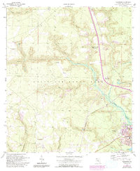
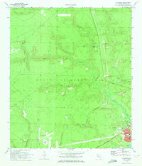
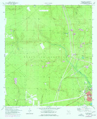
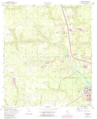
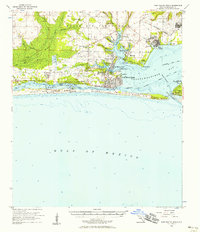
Eglin Air Force Base dominates the landscape of the Florida panhandle in this 1970 survey, photorevised in 1987. The base's massive footprint contains numerous military and correctional landmarks, including the Division of Correction Road Prison and multiple landing sites like Aux Field No 5 (Abandoned) and Aux Field No 4 (Abandoned). A Government Railroad Line bisects the reservation, providing a direct industrial link through the pine-dotted terrain towards the coast.
Find a feature on this map
36 named features on this map. Tap any name to fly to it.
Don’t see what you’re looking for? This feature index may not catch every label — zoom into the map to look around manually.
Map Details
Editions of this 1970 Valparaiso Map
4 editions found
Other maps of this area

1934 · Holt
USGS Topo · 1:48,000

1934 · Niceville
USGS Topo · 1:48,000

1935 · Villa Tasso
USGS Topo · 1:48,000

1936 · Niceville
USGS Topo · 1:62,500

1937 · Holt
USGS Topo · 1:62,500

1938 · Mary Esther
USGS Topo · 1:62,500

1938 · Villa Tasso
USGS Topo · 1:62,500
1956 · Niceville
USGS Topo · 1:62,500
1956 · Fort Walton Beach
USGS Topo · 1:62,500
1956 · Holt
USGS Topo · 1:62,500