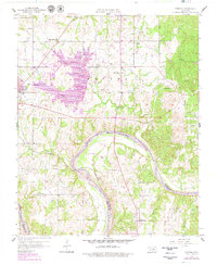
1958 Map of Vamoosa
USGS Topo · Published 1979About this map
The Canadian River defines the southern boundary of this landscape, separating Seminole and Pontotoc counties in a region marked by rural development and infrastructure growth. In the north, Lake Konawa appears alongside industrial landmarks like the Power Plant and Substation, while the surrounding territory is peppered with an extensive Oil Field. The mapping reflects a traditional settlement pattern where numerous small community hubs, such as Vamoosa and Konawa, are anchored by local institutions like Summers Chapel Sch, Seminole Arbeka Ch, and High Spring Ch.
Find a feature on this map
38 named features on this map. Tap any name to fly to it.
Don’t see what you’re looking for? This feature index may not catch every label — zoom into the map to look around manually.
Map Details
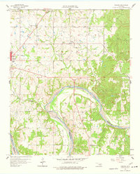
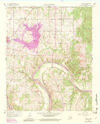
Editions of this 1958 Vamoosa Map
4 editions found

Other maps of this area

1896 · Seminole and Prague
USGS Topo · 1:125,000

1901 · Stonewall
USGS Topo · 1:125,000

1907 · Maud
USGS Topo · 1:62,500

1908 · Maud
USGS Topo · 1:62,500

1954 · Oklahoma City
USGS Topo · 1:250,000

1957 · Ardmore
USGS Topo · 1:250,000

1957 · Oklahoma City
USGS Topo · 1:250,000

1958 · Sasakwa
USGS Topo · 1:24,000

1958 · Francis
USGS Topo · 1:24,000

1958 · Ada
USGS Topo · 1:24,000