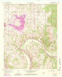
1958 Map of Vamoosa
USGS Topo · Published 1983About this map
Lake Konawa dominates the central landscape of this Seminole County survey, its sprawling shoreline reflecting the post-war industrial development of the region. Adjacent to the lake, the Power Plant and nearby Substation mark the infrastructure supporting the local economy. The terrain is divided by the Canadian River, which meanders along the southern border, marking the boundary between Seminole and Pontotoc Counties.
Find a feature on this map
37 named features on this map. Tap any name to fly to it.
Don’t see what you’re looking for? This feature index may not catch every label — zoom into the map to look around manually.
Map Details
Editions of this 1958 Vamoosa Map
4 editions found

Other maps of this area

1896 · Seminole and Prague
USGS Topo · 1:125,000

1901 · Stonewall
USGS Topo · 1:125,000

1907 · Maud
USGS Topo · 1:62,500

1908 · Maud
USGS Topo · 1:62,500

1954 · Oklahoma City
USGS Topo · 1:250,000

1957 · Ardmore
USGS Topo · 1:250,000

1957 · Oklahoma City
USGS Topo · 1:250,000

1958 · Sasakwa
USGS Topo · 1:24,000

1958 · Francis
USGS Topo · 1:24,000

1958 · Ada
USGS Topo · 1:24,000