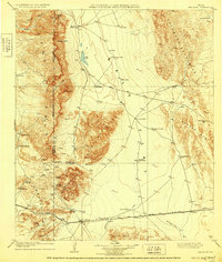
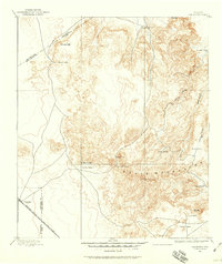
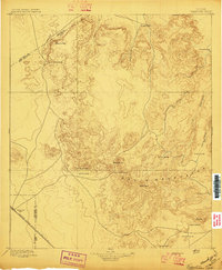
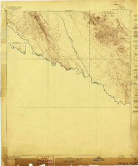
1906 Map of Van Horn
USGS Topo · Published 1929About this map
High-desert cattle ranching and deep-rock mining define this early 20th-century landscape in the Trans-Pecos region. The settlement of Van Horn serves as the primary hub along the Texas and Pacific railroad, which skirts the southern edge of the massive Sierra Diablo and Baylor Mountains. The map reveals a network of family-operated operations including Figure Two Ranch, Bean's Ranch, and Millican's Ranch, each positioned near critical water sources like Apache Spring or artificial tanks. Industrial activity is concentrated at the Hazel Mine and a Marble Quarry in the northern reaches, highlighting the mineral-driven economy of Culberson and El Paso counties before the era of modern irrigation. Arid features like the Salt Lake and Sulphur Creek illustrate the challenging terrain between the Beach Mts and the Apache Mts.
Find a feature on this map
42 named features on this map. Tap any name to fly to it.
Don’t see what you’re looking for? This feature index may not catch every label — zoom into the map to look around manually.
Map Details
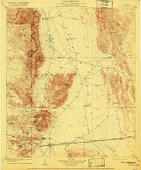
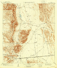
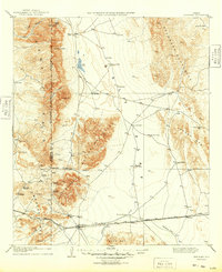
Editions of this 1906 Van Horn Map
5 editions found
Other maps of this area

1892 · Chispa
USGS Topo · 1:125,000
1894 · Valentine
USGS Topo · 1:125,000

1895 · Chispa
USGS Topo · 1:125,000

1895 · Sierra Blanca
USGS Topo · 1:125,000
1897 · Valentine
USGS Topo · 1:125,000
1897 · Eagle Mountain
USGS Topo · 1:125,000

1897 · Chispa
USGS Topo · 1:125,000

1906 · Van Horn
USGS Topo · 1:125,000

1916 · Eagle Mountain
USGS Topo · 1:125,000

1928 · Kent
USGS Topo · 1:125,000