
1954 Map of Van Horn
USGS Topo · Published 1964About this map
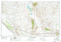
The Rio Grande serves as the international boundary in the southwest corner of this mid-century Trans-Pecos landscape, where the high desert meets a succession of dramatic mountain blocks. The town of Van Horn stands at a strategic crossroads where major highways and the Texas and Pacific railroad converge. To the west, Sierra Blanca marks another vital junction for the Southern Pacific line. The terrain is defined by isolated ranges including the Guadalupe Mountains and the Sierra Diablo, which rise above the alkali flats near Salt Flat. Small, railroad-dependent settlements and sidings like Arispe, Laska Siding, and Etholen Siding dot the southern corridor, while Dell City represents a pocket of agricultural activity in the northern Salt basin. This survey documents the complex transportation network necessary to navigate the vast distances between the Hueco Mountains and the Davis Mountains.
Find a feature on this map
45 named features on this map. Tap any name to fly to it.
Don’t see what you’re looking for? This feature index may not catch every label — zoom into the map to look around manually.
Map Details
Editions of this 1954 Van Horn Map
2 editions found
Other maps of this area

1892 · Chispa
USGS Topo · 1:125,000

1894 · Fort Hancock
USGS Topo · 1:125,000

1894 · Valentine
USGS Topo · 1:125,000

1894 · Fort Davis
USGS Topo · 1:125,000

1895 · Chispa
USGS Topo · 1:125,000

1895 · Sierra Blanca
USGS Topo · 1:125,000

1896 · El Paso
USGS Topo · 1:125,000

1896 · Rio Grande
USGS Topo · 1:125,000

1897 · Valentine
USGS Topo · 1:125,000

1897 · Fort Davis
USGS Topo · 1:125,000